Skip to content
Search
Menu

Bookings here go through Viator, who pay us a commission. You are charged the same either way, and the commission had no say in this list.

Beach

Sandy Neck Beach

Last updated

A six-mile barrier spit with warm bay water on one side, a great salt marsh on the other, and a fly season in July that locals plan around.

Photo: Robert SimmonPublic domain

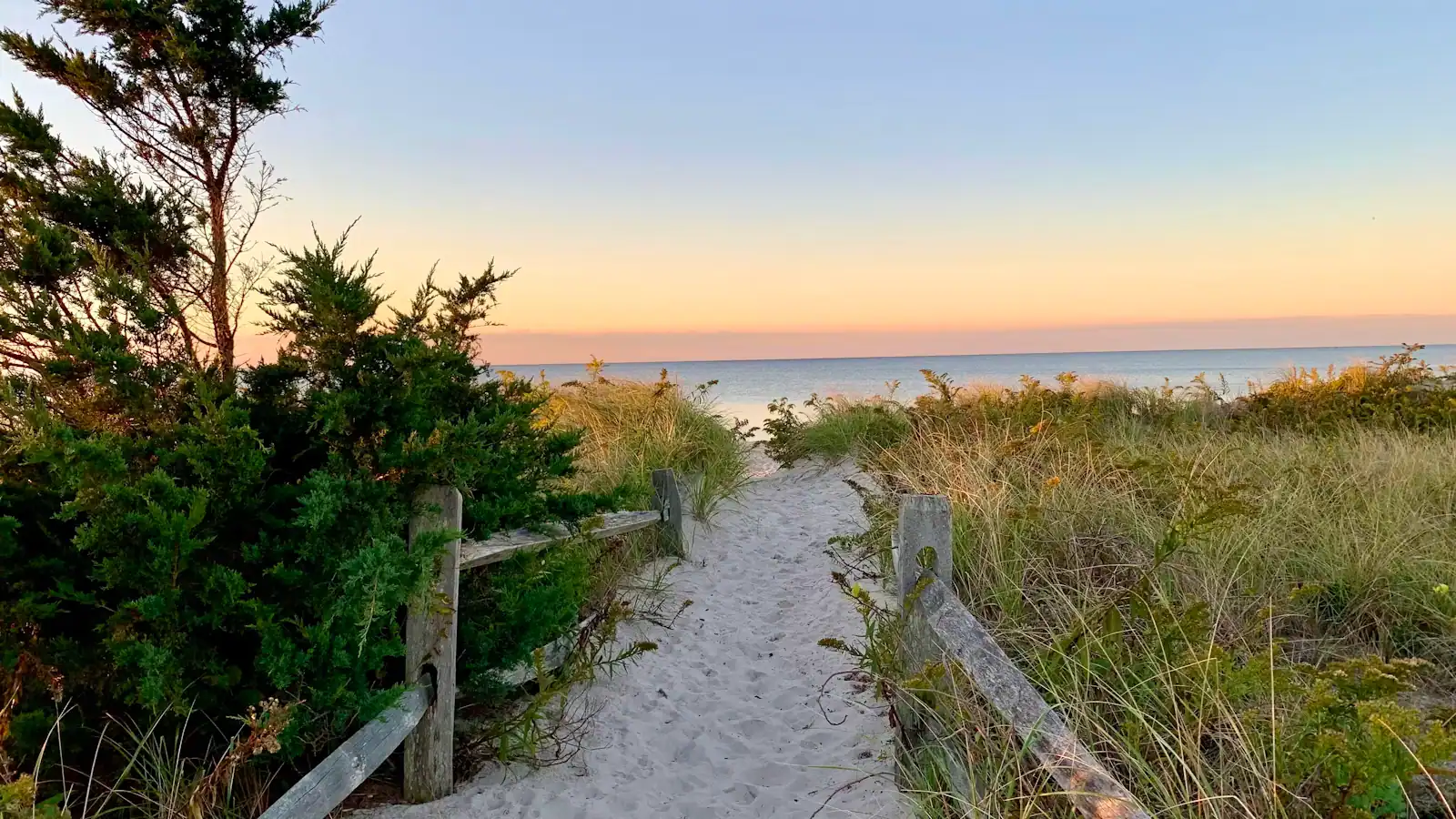
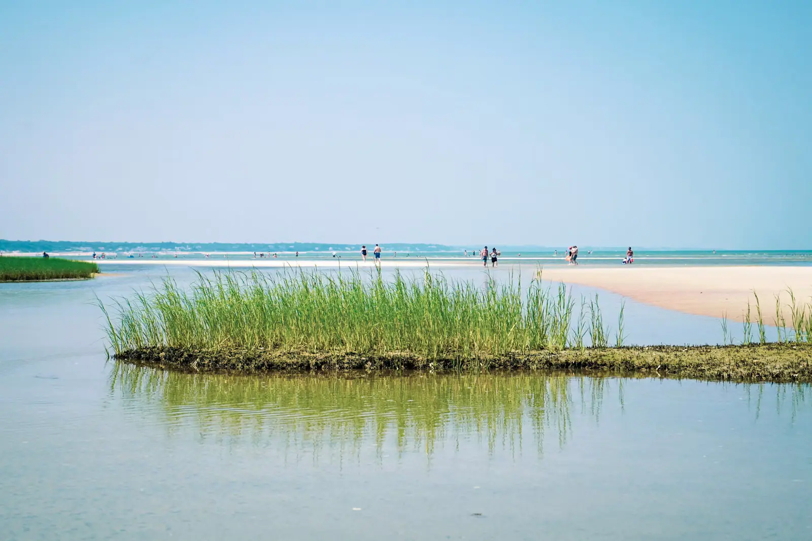
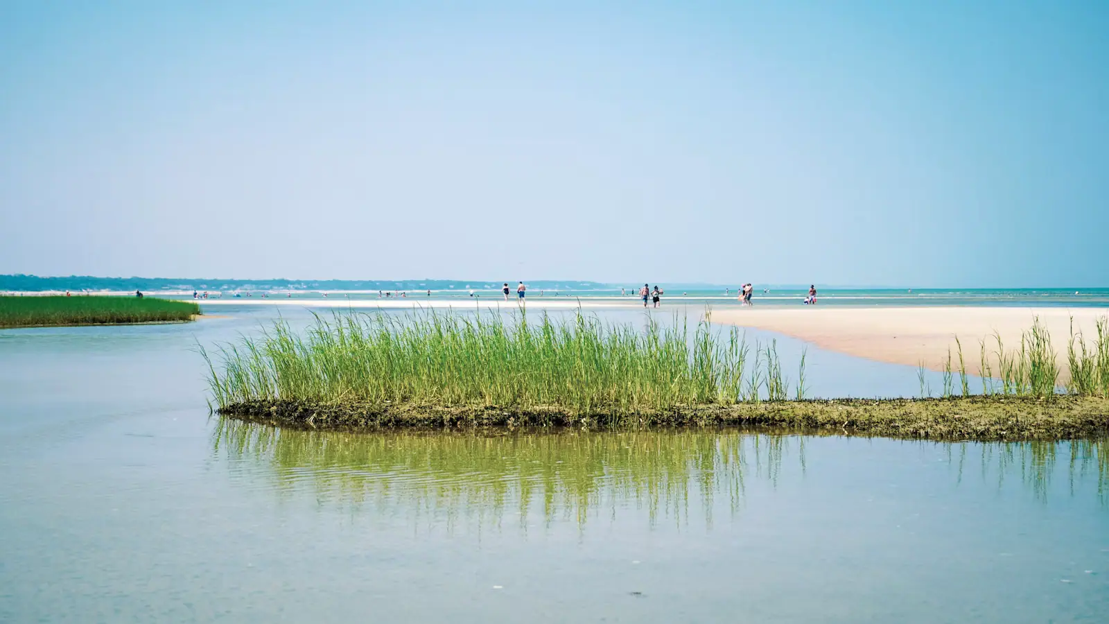
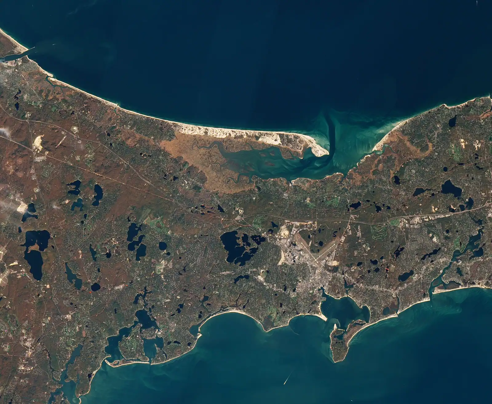
Most visitors meet Cape Cod on the Outer Cape and never come here, which is a mistake with a simple geography behind it. Sandy Neck is a barrier spit running six miles east from Sandwich along the bay shore of Barnstable, and it is one of the largest coastal dune systems in New England. On its north side is Cape Cod Bay. On its south side is the Great Marsh, a vast sheet of salt-meadow grass and tidal creek that the neck has sheltered for thousands of years and that produces the birds, the shellfish and the smell of low tide that define the Mid Cape's bay shore.

The main beach sits at the western end, where the Town of Barnstable runs a gatehouse, a car park, a bathhouse and lifeguards in season. The water is bay water: shallow, sheltered and considerably warmer than the Atlantic side, with flats that widen at low tide but nothing on the scale of Skaket. It is a straightforward, easy beach for families and it is not why people who know Sandy Neck come here.

They come for the neck itself. A designated oversand vehicle trail runs the full length of the spit under a Barnstable permit, and past the beach crowd there is a great deal of empty dune, a historic cottage colony near the far end that has no road and no mains power, and Sandy Neck Light at the point, looking across the harbour mouth.

One warning that belongs at the top rather than the bottom: the greenhead flies in July are not a figure of speech.

Getting there and parking

Sandy Neck Road leaves Route 6A in East Sandwich, close to the Barnstable town line, and runs north to the gatehouse and the main car park. From the Sagamore Bridge allow about twenty minutes; from Hyannis, about twenty-five.

Route 6A is the slow, scenic road along the bay shore — old captains' houses, antique shops and marsh views — and it is worth taking in preference to US-6 if you are not in a hurry.

The oversand trail starts beyond the main lot and requires a Town of Barnstable permit obtained in advance, with equipment requirements checked at the gate.

There is no bus service. The Cape Cod Canal service roads, the flattest cycling on the Cape, are about fifteen minutes west at Sandwich.

The greenhead flies, stated plainly

Salt-marsh greenhead flies breed in the marsh behind the beach and emerge in numbers for a few weeks, typically from about the middle of July into early August. The females bite, the bite is painful, they are persistent, and they are largely indifferent to repellent that works on mosquitoes.

They are worst on hot, still, humid days, and they hunt at ground level along the marsh edge and the back of the beach. A breeze off the bay knocks them down; a windless afternoon in the dunes is when people pack up and leave.

Practical responses that actually help: stay near the waterline where the wind is, go in the water, use a beach tent or umbrella you can sit inside, and check the wind forecast before you commit to the day. The black box traps you see standing in the marsh are the town's control programme, not decoration.

Nobody who lives on this shore is coy about it, and no honest guide should be either. It is a genuine two to three weeks of the summer where the marsh-side beaches of the Mid Cape are unpleasant and the ocean-facing beaches are not. Plan around it rather than being surprised by it.
Driving the neck

The oversand trail runs the length of the spit and is the reason Sandy Neck has a following. It is a Barnstable system, entirely separate from the National Seashore permits used at Race Point, with its own permit categories, its own rules and its own limited numbers.

Requirements follow the usual pattern for soft sand: four-wheel drive, deflated tyres, and a shovel, jack, board and tow rope in the vehicle. Permits are sold by the town by the season, and the popular categories go early. Do not take a rental crossover onto the trail to see what happens; recovery costs more than the permit and the salt does lasting damage.

The trail is closed or rerouted in sections through the shorebird nesting season, which runs from spring into midsummer. Piping plovers and least terns nest on open sand here and the closures are enforced. Check the current status with the town gatehouse before you load the car.

Near the far end sits the Sandy Neck Colony, a cluster of small cottages with no road access, no mains services and a long history. They are private homes. Drive past, do not wander in.

The Great Marsh, and walking instead of driving

You do not need a vehicle to use the neck. A network of marked trails crosses between the dune ridge and the marsh from the gatehouse area, and they are the quietest walking on the Mid Cape.

  • The crossover trails cut from the bay beach to the marsh side at intervals, so you can walk out along the sand and back along the marsh edge for a loop of whatever length suits.
  • Go at low tide on the marsh side for the birds: herons, egrets, willets, and in autumn large numbers of migrating shorebirds working the creeks.
  • There is no shade and no water anywhere on the neck. Carry both.
  • Sand walking is slow. A mile on soft dune sand is not a mile on a path, and people routinely overestimate how far they can comfortably go.
  • Ticks are a real local health concern. Check after any walk through dune grass or scrub, not just wooded trails.
  • Sandy Neck Light stands at the point, on private land, and is best seen from the water or from across the harbour mouth in Barnstable village.

A kayak launched into Barnstable Harbour at the right state of tide is arguably the best way to see the whole system.

Gate, parking and what to expect at the main beach

Sandy Neck is a Town of Barnstable park, so this is another separate payment system: resident stickers, non-resident season passes and a daily rate at the gatehouse, all set annually by the town. Nothing from the National Seashore applies.

The main lot is large by Cape standards and does fill on hot summer days, though generally later than the small bay lots further down the peninsula. There is a bathhouse with restrooms and changing facilities, a seasonal snack concession, and lifeguards during the town's staffed season.

The gatehouse has limited hours outside the season, and the oversand trail has its own opening arrangements. Both change. Ring the gatehouse or check the town's page before an off-season trip.

The water here is shallow, warm by New England standards and gently shelving, with no surf. It is a good beach for small children and a poor one for anybody looking for waves. The Sandwich boardwalk and the Cape Cod Canal service roads are both about fifteen minutes west and make a natural pairing for a day on the Upper Cape.

Near Sandy Neck

Straight-line distances, so allow more on the road — the island is long and has one main parkway.

  • Coloured glass bottles in red, yellow and green arranged on a black metal rack on Cape Cod

    Neighbourhood

    Free

    Sandwich

    Settled in 1637, the Cape's oldest town, and the first thing you reach after the Sagamore Bridge rather than the last.

    3–8 hoursFree to walk. The mill, the historic houses and the museums each charge separately.6.3 mi away

  • A paved pathway running between green grass under an overcast sky

    Water feature

    Free

    Cape Cod Canal

    A 7.4-mile federal waterway with a car-free paved service road down each bank: the flattest, most reliable cycling on Cape Cod.

    1–4 hoursFree. The service roads on both banks are open to walkers and cyclists at no charge.9.7 mi away

  • A paved pathway running between green grass under an overcast sky

    Museum

    Heritage Museums and Gardens

    A hundred acres in Sandwich holding the Dexter rhododendron collection, a vintage car museum and a 1908 carousel you can ride.

    3–5 hoursPaid admission covering the gardens, the museums and a carousel ride; the adventure park is extra6.3 mi away

  • Rows of boats moored in a marina basin on flat water at first light

    Neighbourhood

    Free

    Hyannis

    The Cape's only working downtown: island ferries, an airport, a hospital and a Main Street that stays open in February.

    2–8 hoursFree to walk. Ferries, cruises, concerts and museum admission are separately priced.7.7 mi away

Sandy Neck: common questions

When are greenhead flies bad at Sandy Neck?

Typically for about two to three weeks from the middle of July into early August, and worst on hot, humid, windless days. Salt-marsh greenheads breed in the marsh behind the beach, the females bite hard, and ordinary mosquito repellent does not deter them reliably. A breeze off the bay knocks them down, so stay near the waterline, get in the water, or sit inside a beach tent. Check the wind before you commit to a still afternoon in the dunes.

Can you drive on Sandy Neck Beach?

Yes, on the designated oversand trail with a Town of Barnstable permit. It is a separate system from the National Park Service oversand permits used at Race Point and nothing carries over. You need four-wheel drive, deflated tyres and recovery kit — shovel, jack, board, tow rope — and permits are limited and sell out. Sections of the trail close through the shorebird nesting season from spring into midsummer, so check with the gatehouse before loading the car.

Is Sandy Neck good for swimming?

For easy family swimming, yes. This is Cape Cod Bay, so the water is sheltered, shallow and considerably warmer than the Atlantic beaches on the outer shore, with no shore break and a gentle shelf. It is a poor beach for anyone who wants waves. The main beach has a bathhouse, lifeguards in the town's staffed season and a seasonal snack concession, which is more than most bay beaches offer.

How long is Sandy Neck?

The barrier spit runs about six miles east from Sandwich along the Barnstable bay shore, sheltering Barnstable Harbor and the Great Marsh behind it, and it is one of the larger coastal dune systems in New England. The developed part — gatehouse, car park, bathhouse, lifeguards — occupies only the western end. Everything east of that is dune, marsh edge and oversand trail, plus a private cottage colony near the point that has no road access.