Skip to content
Search
Menu

Bookings here go through Viator, who pay us a commission. You are charged the same either way, and the commission had no say in this list.

Water feature

Cape Cod Canal

Last updated

A 7.4-mile federal waterway with a car-free paved service road down each bank: the flattest, most reliable cycling on Cape Cod.

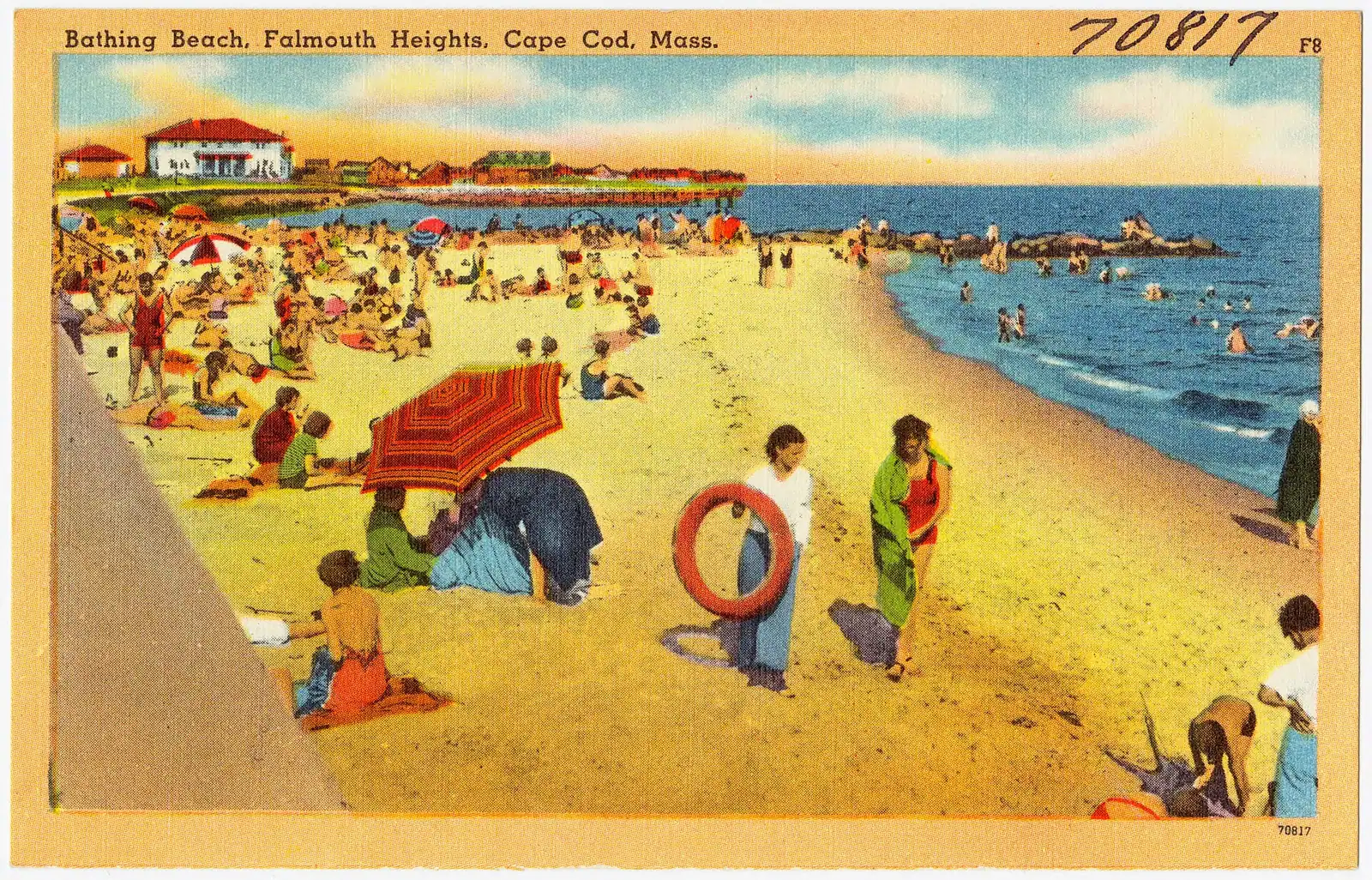
Photo: Tichnor Bros. Inc., Boston, Mass.Public domain

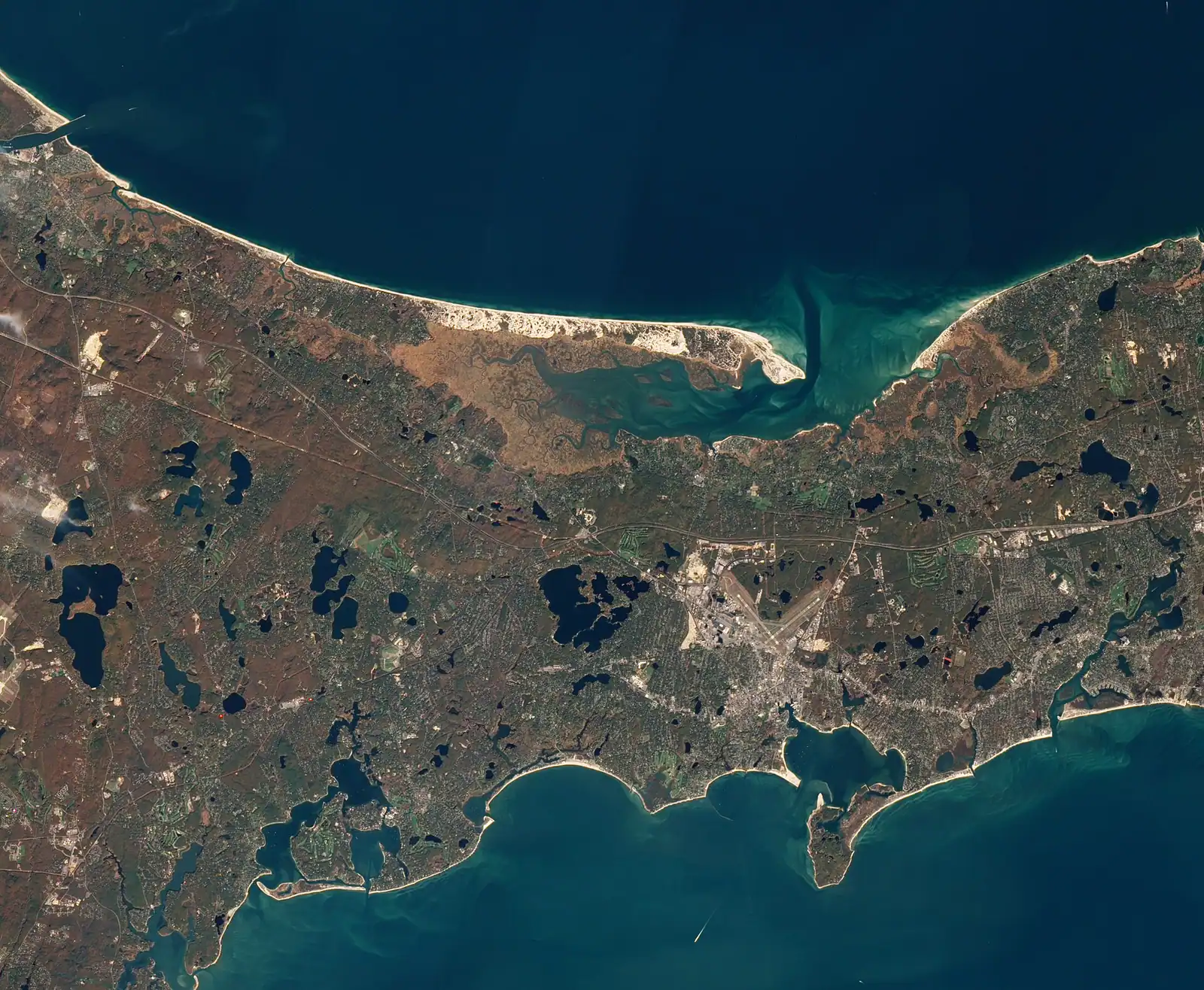
The Cape Cod Canal is the reason people say Cape Cod is technically an island, and it is the most underrated free attraction on the peninsula. It runs about 7.4 miles from Cape Cod Bay to Buzzards Bay, 480 feet wide and 32 feet deep at mean low water, which makes it one of the widest sea-level canals anywhere. Digging started on 22 June 1909 under August Belmont Jr, it opened on a limited basis on 29 July 1914, and the federal government bought it in 1928 for $11.4 million. It has been free to transit and operated by the US Army Corps of Engineers ever since.

What that history produces for a visitor is unusual. Because it is a federal navigation project rather than a park, there is a maintained paved service road down each bank for its full length, closed to public traffic and open to walkers and cyclists. No hills, no cars, no junctions, and a working shipping channel a few feet away. Tankers, barges, tugs, the occasional naval vessel and a steady stream of yachts pass close enough that you can read the names. It is the flattest and most dependable cycling on Cape Cod and it is open year round, which almost nothing else here is.

The water itself is not benign. The tide runs through the cut and reverses roughly every six hours, reaching about 5.2 miles an hour on the ebb, which is faster than most people can paddle. Small craft time their transit around it and a traffic light system controls vessels over 65 feet. Swimming in the canal is prohibited and the current is the reason.

Anglers know the canal for striped bass. The fish move through on the running tide and the east end at Scusset and the rock riprap along both banks fill with fishermen on a good tide in June, often well before dawn. It is genuinely one of the best shore fisheries in the Northeast.

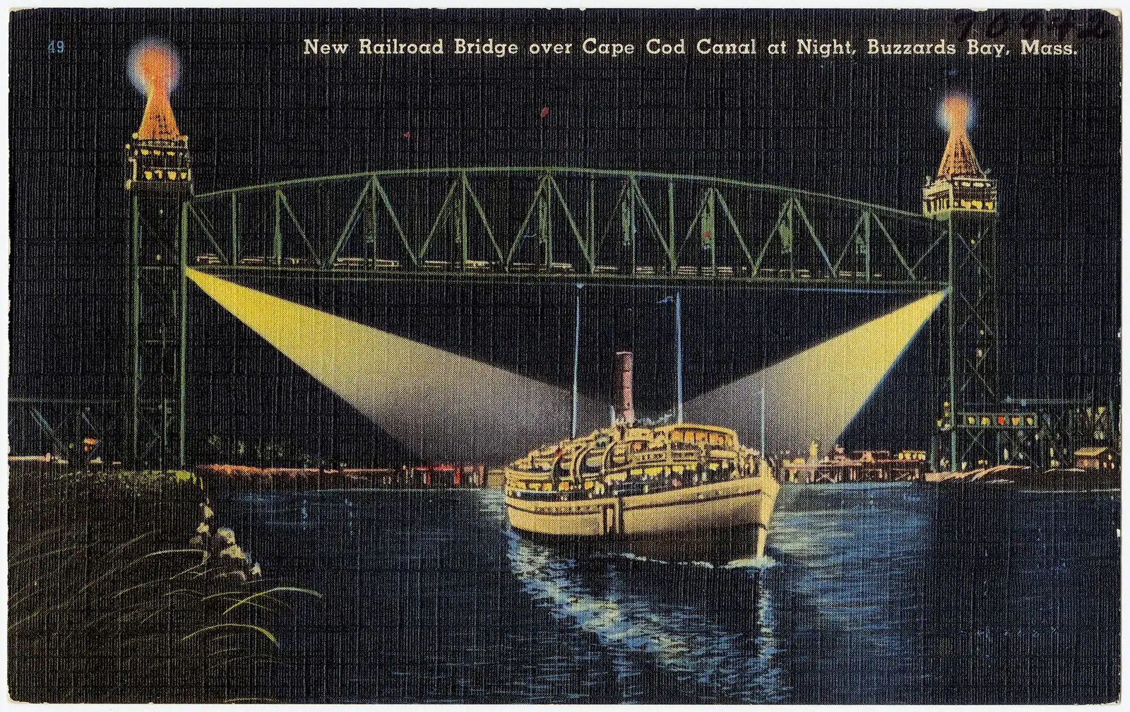
Three bridges cross it: the Bourne and Sagamore highway spans of the 1930s, and the railroad lift bridge that sits raised between trains. All of them are visible from the path.
Getting there and parking

Access points with car parks are spaced along both banks. On the Cape side, the Sandwich end near the Army Corps visitor centre and the Bourne recreation area beside the railroad bridge are the two easiest. On the mainland side, Scusset Beach State Reservation at the east end and the Buzzards Bay waterfront at the west end both give direct access to the north bank path.

From the Sagamore Bridge, drop off Route 6 at the first opportunity and follow signs for the canal or for Scusset Beach. From the Bourne Bridge, the recreation areas on both banks are signed within a mile.

There is no bridge for pedestrians or cyclists between the two banks other than the highway spans themselves, which have narrow sidewalks and are unpleasant on foot. Choose a bank and stay on it.

Parking is free at most access points, though Scusset Beach State Reservation charges a day-use fee in season. The lots nearest the bridges fill early on summer weekends and before dawn during a good striped bass run.

The seasonal CapeFLYER weekend train from Boston crosses the canal on the railroad lift bridge in summer and continues to Hyannis.

The service roads, which are the point

Each bank carries a paved service road of roughly seven miles, maintained by the Army Corps for access to the waterway and open to the public on foot and by bike. There are no road crossings on either bank. That is rarer than it sounds and it is why parents put small children on bikes here rather than on the rail trail.

The north bank, on the mainland side, runs from the Cape Cod Canal Railroad Bridge area east towards Scusset Beach. The south bank, on the Cape side, runs from Bourne east towards Sandwich and the eastern entrance. Access points with car parks are spaced along both, including at Scusset Beach, at the Sandwich end near the Army Corps visitor centre, at Bourne and near the railroad bridge.

Fourteen miles of round trip on either side is a straightforward morning for a moderately fit rider and a long walk for anyone else. There is no shade to speak of and no shelter, which matters both in July and in a February easterly.

The wind is the variable rather than the gradient. The canal runs roughly east to west and funnels whatever is blowing, so the outward leg and the return leg can feel like two different rides. Ride into it first.

The paths are open year round, which makes the canal the answer to the question of what there is to do on Cape Cod in March.

Watching the traffic, and why the current matters

The canal handles something in the order of fourteen thousand vessel transits a year, which averages out to a boat every few minutes on a summer day and considerably less in February.

Commercial traffic is the interesting part: tugs with barges, tankers supplying the region, the occasional cruise ship or naval vessel, and the Steamship Authority's freight movements. Because the channel is only 480 feet wide, everything passes close to the bank, and there is no other place on the American east coast where you can stand this near to a working shipping lane on a paved path.

The tide is the thing to understand. Cape Cod Bay at the east end and Buzzards Bay at the west end do not have their high waters at the same time, and the difference drives a strong current through the cut that reverses roughly every six hours. On the ebb it can reach about 5.2 miles an hour. Small boats wait for a fair tide rather than fight it.

Vessels over 65 feet operate under a traffic light system controlled from the Army Corps' marine traffic centre, which is why you will sometimes see a large ship holding at one end.

Swimming is prohibited, and the current rather than the shipping is the reason. Do not treat the canal as water to get into at any state of tide.

The Army Corps runs a visitor centre near the Sandwich end with exhibits on the canal's construction and operation. It opens seasonally.

Striped bass, and the etiquette of the rocks

  • The canal is a shore fishery of national reputation, principally for striped bass, with bluefish and mackerel in their runs.
  • Tide over time of day. Fish move on the running water. Serious canal anglers plan around the tide table and are frequently in position before first light, particularly in June.
  • The riprap is rough footing. Both banks are lined with granite blocks that are uneven, often wet and occasionally slick with weed. Sturdy boots, not trainers.
  • A Massachusetts recreational saltwater permit is required for most adult anglers. Check current rules and any striped bass size and bag limits before you fish, because they change.
  • Bikes and rods share the path. Anglers ride the service road with rods, and cyclists pass at speed. Both sides know this; neither always acts like it.
  • Parking fills before dawn at the popular access points during a hot bass bite. Scusset and the east end are the busiest.
  • Take everything home. Discarded line on the rocks is a problem here specifically because the same rocks are used by cormorants and gulls.

The bridges, and the replacement that is coming

The Bourne and Sagamore highway bridges both date from 1935, and they are the single defining constraint on travel to Cape Cod. Two crossings carry everything: every summer rental, every delivery, every commuter. On a Friday afternoon in July the queue for the Sagamore is the Cape's most reliable experience.

Both are slated for replacement. The programme is funded at roughly $2.4 billion, the state environmental review certified its final report in April 2026, and the Federal Highway Administration issued its Record of Decision in June 2026. Sagamore goes first. MassDOT has anticipated a notice to proceed on the design-build contract in late 2027, construction from the winter of 2027/28, and traffic moving onto a new span around 2033.

Every one of those dates is a plan rather than a promise. This project's schedule has moved before and may move again. Check the current position before building a trip around it, and expect construction-period disruption once it starts.

The third crossing is the Cape Cod Canal Railroad Bridge, a vertical lift span that sits raised with its counterweights up and lowers for trains, including the seasonal CapeFLYER weekend service from Boston. Watching it come down is worth timing if you can find out when a train is due. It is the most photographed structure on the canal and the best view of it is from the Bourne recreation area on the south bank.

Near The Canal

Straight-line distances, so allow more on the road — the island is long and has one main parkway.

  • Coloured glass bottles in red, yellow and green arranged on a black metal rack on Cape Cod

    Neighbourhood

    Free

    Sandwich

    Settled in 1637, the Cape's oldest town, and the first thing you reach after the Sagamore Bridge rather than the last.

    3–8 hoursFree to walk. The mill, the historic houses and the museums each charge separately.3.6 mi away

  • A paved pathway running between green grass under an overcast sky

    Museum

    Heritage Museums and Gardens

    A hundred acres in Sandwich holding the Dexter rhododendron collection, a vintage car museum and a 1908 carousel you can ride.

    3–5 hoursPaid admission covering the gardens, the museums and a carousel ride; the adventure park is extra3.5 mi away

  • Salt marsh grass and a winding tidal channel under a wide overcast sky on Cape Cod

    Beach

    Free

    Sandy Neck Beach

    A six-mile barrier spit with warm bay water on one side, a great salt marsh on the other, and a fly season in July that locals plan around.

    2–6 hoursFree to enter. Town of Barnstable parking: daily rate at the gatehouse or a season sticker.9.7 mi away

  • A paved pathway running between green grass under an overcast sky

    Neighbourhood

    Free

    Falmouth

    The Cape's second-largest town, reached over the Bourne Bridge without ever joining the Route 6 queue.

    3–8 hoursFree to visit. Town beach lots require a Falmouth sticker or daily fee in season.14.2 mi away

The Canal: common questions

Can you bike along the Cape Cod Canal?

Yes, and it is the flattest and most reliable cycling on Cape Cod. The Army Corps of Engineers maintains a paved service road of roughly seven miles down each bank, closed to public traffic and open to walkers and cyclists, with no road crossings at all on either side. A full round trip on one bank is about fourteen miles. The paths stay open year round, which almost nothing else on the peninsula does.

Can you swim in the Cape Cod Canal?

No. Swimming is prohibited, and the reason is the current rather than the shipping. Cape Cod Bay and Buzzards Bay do not reach high water at the same time, and the difference drives a tidal stream through the cut that reverses roughly every six hours and can reach about 5.2 miles an hour on the ebb. That is faster than a strong swimmer. Scusset Beach at the east end is the place to get in the water instead.

When are the Cape Cod bridges being replaced?

The Bourne and Sagamore spans both date from 1935 and both are slated for replacement under a programme funded at roughly $2.4 billion. The state environmental review was certified in April 2026 and the Federal Highway Administration issued its Record of Decision in June 2026. Sagamore goes first, with a design-build notice to proceed anticipated in late 2027 and traffic on a new span around 2033. Treat all of those dates as plans, not promises.

Is the Cape Cod Canal good for fishing?

It is one of the best shore fisheries in the Northeast, principally for striped bass, with bluefish and mackerel in their runs. Fish move on the running tide, so serious canal anglers plan around the tide table rather than the clock and are often in position before first light in June. The granite riprap lining both banks is uneven and frequently slick, so wear boots. A Massachusetts recreational saltwater permit is required for most adult anglers.

How long is the Cape Cod Canal?

About 7.4 miles, running from Cape Cod Bay to Buzzards Bay, 480 feet wide and 32 feet deep at mean low water. Construction began on 22 June 1909 under August Belmont Jr and it opened on a limited basis on 29 July 1914. The federal government bought it in 1928 for $11.4 million, and it has been toll-free and operated by the US Army Corps of Engineers ever since, handling something in the order of fourteen thousand vessel transits a year.